
If you are interested in financing to fund your Bay-Lynx purchase, we recommend that you connect with Easylease Corp., a Canadian-based leasing and finance company that offers premier equipment leasing and financial services. They are focused on making it easier than ever before for companies to overcome cash flow and resource constraints to acquire the assets they need to grow their business.
Leasing through Easylease Corp. can offer several benefits:
Click here for your Canadian instant lease quote >>
For US customers, Click here for your instant lease application >>
Wildfires are moving faster, burning hotter, and challenging crews across larger landscapes. In this environment, Firefighting Drones offer more than dramatic aerial footage. They provide thermal images, live mapping, and safer access to steep or burning terrain.
As public-safety UAS expert Charles Werner puts it, “Drones are the first responder’s eyes in the sky.” That perspective matters during the first critical minutes. A drone can reveal hidden heat beneath smoke, identify shifting fire edges, and help commanders protect evacuation routes. It can also monitor water drops, damaged infrastructure, and isolated hotspots after the main flames pass.
This guide examines the 10 Best Firefighting Drones for Wildfire Response in 2026. The selection considers thermal-camera quality, flight endurance, wind stability, obstacle sensing, communications, payload flexibility, and field serviceability. Those details decide whether a drone remains useful after dust, ash, and long missions.
Not every advanced model belongs on a fireline. Some aircraft promise impressive range but depend heavily on network coverage. Others carry strong sensors yet struggle with battery logistics. A few are expensive, complicated, or too delicate for repeated deployment.
The best choice depends on the mission. A small drone may scout a narrow canyon quickly. A larger platform may support thermal mapping for hours. Neither replaces trained firefighters, incident commanders, or sound judgment. Technology can fail. Smoke can confuse sensors. Batteries can drain faster than expected.
That uncomfortable reality deserves attention. Firefighting Drones are powerful decision-support tools, not magical solutions. Their value comes from disciplined crews, realistic training, reliable maintenance, and careful interpretation of every image.
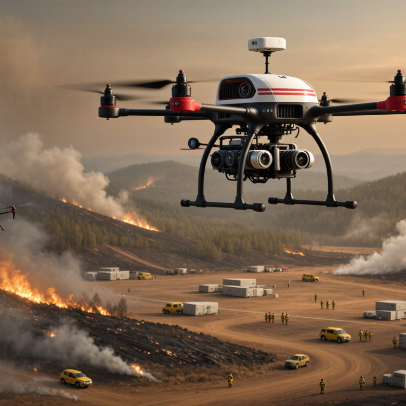
Wildfire response drones extend the reach of crews working near smoke, steep slopes, and unstable firelines. Their roles include thermal scouting, perimeter mapping, hotspot detection, and real-time video support. A drone can show heat beneath tree cover before flames become visible. It can also identify blocked roads, isolated structures, and changing wind conditions. Still, aerial data must support trained incident commanders, not replace them.
Capability matters more than impressive specifications. Look for stable flight in strong winds, useful endurance, and reliable operation around smoke. Thermal sensors should distinguish warm rocks from active hotspots. High-resolution cameras help inspect power lines, roofs, and access routes. A secure data link is essential when terrain interrupts communications. Night operation can improve coverage, but pilots need clear procedures and strong situational awareness.
Selection should begin with the mission, not the aircraft. A compact system may suit rapid reconnaissance, while a heavier platform can carry additional sensors or firefighting payloads. Evaluate launch time, battery changes, weather resistance, maintenance needs, and training requirements. Test the drone with gloves, low visibility, and noisy command vehicles. Field trials often expose weaknesses that brochures hide. Longer flight time is not always better if charging takes too long. Teams should also question whether automated mapping remains accurate through dense smoke, because it may not.
Firefighting drones turn a chaotic wildfire into a time-stamped, three-dimensional map. Thermal cameras locate hotspots through darkness and light smoke. Optical cameras show flame fronts, fallen trees, roads, and exposed structures. The National Interagency Coordination Center reported 8,924,884 acres burned across the United States in 2024. That scale makes rapid local mapping essential.
A drone can follow a preplanned grid and record overlapping images. Software then builds an orthomosaic map and elevation model. Incident teams compare each flight with earlier data, tracking perimeter growth, ember activity, and hidden heat. The National Oceanic and Atmospheric Administration reports that geostationary satellites can scan severe weather regions every 5–15 minutes. Drones add closer detail, especially beneath cloud cover or near steep terrain. Smoke lies.
Monitoring requires disciplined interpretation. Hot rocks, sunlit metal, and ash can imitate fire in infrared imagery. Wind can also move smoke faster than a drone team expects. Battery limits, weak links, and changing flight restrictions interrupt otherwise useful missions. The International Association of Wildland Fire emphasizes common operating pictures and reliable field observations during incident management. Crews should validate drone findings with ground reports, weather data, and repeat flights. Maps age quickly. A single impressive image may still miss a fire hidden behind a ridge. These limits deserve more attention in any 2026 equipment comparison.
Comparing the 10 Best Firefighting Drones for 2026 requires more than checking payload size.
The strongest candidates combine thermal imaging, long endurance, reliable mapping, and stable links in smoke. A useful drone should locate hidden heat beneath tree cover. It should also track wind direction near a moving fireline. Payload capacity matters, but water drops remain limited. A larger aircraft may carry more suppressant, yet it can become difficult to launch from steep, crowded terrain. Smaller aircraft often provide faster reconnaissance and safer close-range inspection.
Night capability separates serious systems from convenient tools. Clear thermal images can reveal hot spots beside blackened trunks, even when visible smoke blocks the ground. The best 2026 options should support layered teams: scouts map the perimeter, heavier units inspect priority zones, and command staff receive consistent data. That sounds efficient. It is not always simple.
Battery performance changes in cold mountain air. Signal loss can occur behind ridges. My concern is that rankings may overvalue laboratory endurance. Field reliability deserves more weight, especially when operators work beside heat, ash, and sudden wind. Performance data should be tested repeatedly, not accepted from one demonstration.
The 10 Best Firefighting Drones for Wildfire Response in 2026 should be judged by mission value, not impressive specifications. Thermal cameras can locate hidden hotspots beneath smoke. Mapping drones can update fire perimeters after wind shifts. Night operations may support safer patrols, while relay aircraft can extend communications in remote terrain. Some systems can deliver small amounts of water or approved suppressant, but their effect remains limited during large, fast-moving fires.
Safety must begin with incident command. Every flight needs a trained remote pilot, a clear launch zone, and coordination with crewed aircraft. Operators should check wind, visibility, battery temperature, and signal strength before takeoff. Geofencing alone is not enough. Crews still need visual awareness and reliable radio contact. Emergency landing plans matter when smoke blocks navigation. A perfect drone plan does not exist; field conditions often expose weak assumptions.
Tips: Maintain flight logs, inspect propellers, and record battery cycles. Use thermal images with ground verification before directing crews. Follow local aviation rules, wildfire agency procedures, privacy requirements, and restricted-airspace controls. Regulatory obligations may include pilot certification, aircraft registration, remote identification, operating approvals, and documented risk assessments. Requirements differ by country and mission type, so agencies should confirm current rules with the relevant aviation authority. Test procedures during drills, not during a crisis.
| Rank | Drone Configuration | Best Operational Use | Typical Flight Time | Useful Payloads | Operational Strengths | Main Limitations | Key Safety Measures | Typical U.S. Regulatory Requirements |
|---|---|---|---|---|---|---|---|---|
| 1 | Thermal-Imaging Multicopter | Rapid hotspot detection, perimeter checks, structure protection, and night reconnaissance. | Approximately 25–45 minutes per battery, depending on wind, temperature, and payload. | Radiometric thermal camera, visible-light camera, spotlight, and laser rangefinder. | Vertical takeoff and landing, precise hovering, high-resolution imaging, and quick deployment. | Limited coverage compared with fixed-wing systems; battery performance decreases in cold or strong wind. | Maintain separation from aircraft and personnel, monitor battery reserves, and avoid flying directly through smoke or excessive heat. | Remote pilot certification under FAA Part 107, aircraft registration, Remote ID compliance when required, and authorization for controlled airspace. |
| 2 | Long-Endurance Fixed-Wing VTOL | Large-area fire mapping, smoke-front tracking, and repeated perimeter surveys. | Approximately 2–8 hours, depending on aircraft size, weather, and sensor load. | Multispectral or thermal imaging payload, mapping camera, and high-precision positioning system. | Efficient long-distance flight, broad-area coverage, and strong mapping productivity. | Needs a suitable launch or recovery area; generally cannot hover for detailed inspection. | Use defined launch and recovery zones, establish lost-link procedures, and coordinate operations with crewed aviation. | Part 107 or an applicable public-aircraft authorization, airspace approval, Remote ID where applicable, and a waiver or approval for operations outside normal visual-line-of-sight limits. |
| 3 | Heavy-Lift Multicopter | Transporting small emergency supplies, communications equipment, water, or medical items to isolated locations. | Approximately 15–35 minutes with a substantial payload. | Cargo box, medical kit, radio relay, water or retardant test payload, and delivery winch. | Can reach steep or dangerous terrain without exposing ground crews to unnecessary travel risks. | Reduced endurance, greater kinetic risk, and stricter payload and drop restrictions. | Confirm payload security, calculate center of gravity, use exclusion zones, and prohibit uncontrolled release over people or occupied areas. | Part 107 operating rules, aircraft registration and Remote ID where applicable; transporting or dropping material may require additional FAA authorization or waiver conditions. |
| 4 | Tethered Observation Drone | Persistent overwatch from an incident command post, evacuation route, or fireline observation point. | Several hours or longer while connected to a ground power unit, subject to system limits. | Daylight and thermal cameras, spotlight, loudspeaker, and communications relay. | Continuous surveillance, stable power supply, and reduced battery-change workload. | Restricted movement, cable entanglement hazards, and vulnerability to high winds or falling debris. | Secure the tether, mark the operating area, protect the ground station, and lower the aircraft before severe wind or lightning conditions. | The operation still falls under applicable FAA rules; airspace authorization, registration, Remote ID applicability, and public-safety approvals must be assessed. |
| 5 | Communications-Relay Drone | Extending radio, cellular, or data connectivity in canyons and areas where infrastructure has failed. | Approximately 30–90 minutes, depending on relay equipment and aircraft size. | Radio repeater, mesh-network node, cellular relay, and directional antennas. | Improves coordination between incident command, field teams, and evacuation resources. | Radio-frequency interference, limited payload endurance, and dependence on line-of-sight network geometry. | Coordinate frequencies, encrypt sensitive traffic, maintain a backup communications plan, and keep the aircraft clear of emergency helicopters. | FAA operational authorization plus compliance with applicable Federal Communications Commission frequency and power rules. |
| 6 | Mapping and Photogrammetry Drone | Creating updated orthomosaics, terrain models, fireline maps, and damage assessments. | Approximately 30–60 minutes per sortie. | High-resolution mapping camera, multispectral sensor, and survey-grade positioning equipment. | Produces repeatable geospatial data for planning, resource allocation, and after-action analysis. | Smoke, changing illumination, vegetation movement, and poor ground-control visibility can reduce data quality. | Use preplanned routes, verify georeferencing, avoid flying over active crews, and protect imagery containing sensitive locations. | Part 107 or public-aircraft authorization, airspace approval, Remote ID where applicable, and a waiver if the mission requires operations beyond standard limits. |
| 7 | Night-Operations Thermal Drone | Detecting residual heat, identifying spot fires, and supporting night patrols when crewed aviation is restricted. | Approximately 25–45 minutes per sortie. | Thermal camera, low-light camera, navigation lights, and obstacle-sensing equipment. | Improves visibility of concealed heat sources and can reduce the need for hazardous nighttime ground searches. | Reduced visual depth perception, thermal clutter, smoke obscuration, and increased collision risk. | Use a trained visual observer when required, maintain anti-collision lighting, establish conservative altitude limits, and apply a documented night checklist. | FAA Part 107 permits certain night operations only when applicable lighting, training, and operational requirements are met; controlled airspace approval may also be required. |
| 8 | Confined-Space Inspection Drone | Inspecting structures, culverts, industrial sites, mines, and narrow areas after fire exposure. | Approximately 8–25 minutes per battery. | Protected camera system, thermal sensor, lighting, and collision-tolerant frame. | Reduces entry risks for firefighters and supports rapid visual assessment in unstable environments. | Short endurance, signal attenuation, dust, heat, and unreliable positioning in enclosed spaces. | Complete a structural and atmospheric hazard assessment, use a spotter, avoid energized equipment, and follow confined-space procedures. | FAA rules still apply outdoors; indoor-only flight may be treated differently, but site-owner authorization, worker-safety rules, and local policies remain necessary. |
| 9 | Multi-Drone Mapping Fleet | Rapidly updating fire perimeters and comparing multiple sectors during a large, complex incident. | Approximately 25–60 minutes per aircraft, with continuous coverage through battery rotation. | Thermal cameras, mapping cameras, automated mission software, and shared geographic information systems. | Scales coverage, reduces mapping gaps, and supports frequent updates for incident command. | Higher coordination workload, radio congestion, data-management complexity, and increased airspace conflict potential. | Use one air-operations coordinator, assign unique flight sectors, maintain positive aircraft identification, and establish immediate landing procedures. | Each aircraft and pilot must be covered by the applicable authorization; BVLOS, automated operations, and multi-aircraft control may require specific FAA approval or waiver relief. |
| 10 | Small Rapid-Deployment Microdrone | Immediate reconnaissance from a hand crew, quick visual checks, and assessment of narrow trails or fire shelters. | Approximately 10–30 minutes per battery. | Compact visible-light camera, basic thermal sensor, and obstacle-avoidance system. | Lightweight, portable, fast to launch, and suitable for teams operating far from vehicles. | Lower wind resistance, shorter range, limited sensor performance, and smaller data-storage capacity. | Keep the pilot close to the team, avoid smoke columns and rotor wash near loose ash, maintain visual awareness, and secure spare batteries from heat. | FAA registration and Remote ID requirements depend on aircraft weight and operating conditions; Part 107, airspace authorization, and emergency-incident coordination may still apply. |
10 Best Firefighting Drones for Wildfire Response in 2026
Choosing the Right Drone for Different Wildfire Scenarios
Wildfire drones should match the mission, not merely carry the largest payload. For initial detection, choose a compact aircraft with thermal imaging, sharp optical zoom, and fast deployment. It can identify a glowing hotspot through smoke before crews enter unstable terrain. The National Interagency Fire Center reported more than eight million U.S. acres burned in 2024, reinforcing the need for rapid aerial intelligence.
Large fires require longer endurance, stronger wind resistance, and dependable night operation. Thermal mapping helps incident commanders track fire edges, while multispectral sensors can reveal stressed vegetation beyond visible flames. For steep forests, a quieter, obstacle-aware drone reduces collision risks near trees and ridgelines. A heavy-lift model may support water or suppressant delivery, but its usefulness drops when wind, heat, or limited battery capacity affects accuracy.
Tips: Test thermal cameras in smoke, not only clear weather. Plan spare batteries and landing zones. Keep one operator focused on flight safety. Remote identification, airspace coordination, and local emergency procedures must be confirmed before deployment.
The Federal Aviation Administration emphasizes trained operations and controlled airspace awareness. Field experience also shows a less obvious weakness: sensor readings can mislead crews when smoke layers distort temperature patterns. Drones improve decisions, but they do not replace ground verification. Sometimes, the most expensive aircraft is the wrong choice.